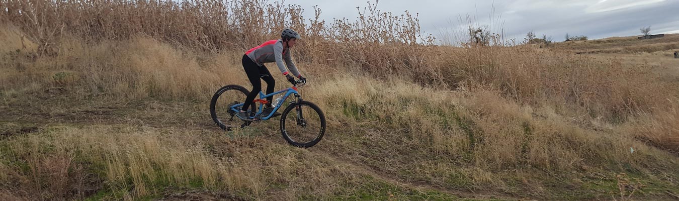
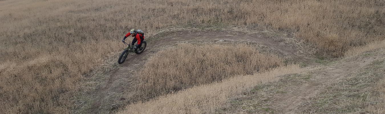
Pendleton Adventure Trails Recreation Area (PATRA)
With 6 trails to choose from, you can cover about 18 miles through the fields located just below the Pendleton Airport. There is a 2 mile easy loop for beginning mountain bikers. The rest of the trails go up and down hills with switchbacks providing a thrilling ride, hike, or run from start to finish. The trails are located off NW A Street about 1/2 mile down the road from the Pendleton Airport on the left. No running water. Please pack out any garbage. No motorized vehicles.
Are you interested in events at the Pendleton Adventure Trails Recreation Area? or Interested in helping with trail maintenance, like tumbleweed control?
Be sure to download TrailForks or MTB Project in the Google Play or Apple iTunes store for FREE!

Trailforks provides full GPS routes and ratings of all the current running, biking, hiking trails in the PATRA system. Trailforks lets you use your phone to follow routes as you walk the PATRA trail network and stay on course. All routes are marked in PATRA for easy navigation. You also get current trail conditions, or leave the trail status as you hike, run, or ride trail network! Be sure to leave comments and rate the trails as you use Trailforks!
Pendleton Adventure Trails Recreational Area

MTB Project provides full GPS routes and ratings of all the current running, biking, hiking trails in the PATRA system. MTB Project lets you use your phone to follow routes as you walk the PATRA trail network and stay on course. All routes are marked in PATRA for easy navigation. You also get current trail conditions, or leave the trail status as you hike, run, or ride trail network! Be sure to leave comments and rate the trails as you use MTB Project!
The trails are maintained by volunteers and the Pendleton Parks and Recreation Department. Please contact us if you would like to participate in trail maintenance.
We appreciate your interest in the Pendleton Adventure Trails.
Pendleton Adventure Trails Work Group
- Amanda Brown
- Gary Parker
- Rachael Plunkett
- Zack Rock
- Ailea Villanueva
Trail Details
There are several trails that drop down from this and head down the ridges and canyons, so this trail serves as access to those trails, or it can be ridden as a nice easy loop. This is a great trail for anyone looking to experience a nice easy loop.
Once you hit Tim’s trail after a small drop, you will continue down this fast portion of trail for about 400 yards until you take a right again on Graveyard. There is a well marked sign.
The upper half of Graveyard is technical black diamond rocks, drops, and boulders, while the lower half is blue/green fast, flowy and fun.
There are a few variations you can take from this trail at mid-point. First, you could take a left and get back onto Tim’s trail and head back up toward the top, or follow Tim’s trail down to the bottom. Another popular choice is to take a left and drop down into graveyard, which that follows the rocky drainage to the bottom. You can also take a right at the mid-way point and ride back uphill on a couple switchbacks and gain the west ridge and drop into Zig Zag one canyon over to the west.
You can cut left and ride back up the gravel road, or you can continue down the slope past the large radio tower. There are some big berms down low followed by a drop at the bottom of the trail. Stay left to ride back up Tim’s trail, straight to continue up Stem Cell, or take a hard right and come back up Qit Qit.
From the start, you simply head south west toward I-84 and will begin a series of switchbacks and turns toward the top. Once you crest the steep hillside, you have a small reprieve downhill as you head west and then more switchbacks to the very top corner. Once you make the corner, you will turn back East and head down some fun switchbacks and over a drop back toward the bottom.
You can ride out Tim’s trail as it will lead you back to the top parking lot.
To start the trail, it is easily accessed by riding stem cell and turning left/north toward the field near the bottom corners. You can also start by riding stem cell backwards past 2 switchbacks and then head north on a primitive trail that is marked with flags and follows the edge of the wheat field for about 800 yards. the uphill will meander through the various mounds of dirt and then begin switchbacks as you climb toward the top west side.
Once you reach the top, you are greeted with a few fast switchbacks, rolling drop over a rock ledge, and then into 2 larger mounts that can be jumped as big as you can go. Roll them if you like, or try to clear 25 feet, you can hit them as fast as you can go.
Continue down past several swooping turns and take a left onto another new trail in this area, or continue to the bottom, stay left into the drainage and hit a ladder bridge/huge berm/ladder bridge as you work your way out the bottom of the drainage.
The trail is normally ridden clockwise and you will switchback down and through some ravens, heading down along the hillside until you reach a gate crossing and a road. You will have to go through the gate and immediately head back west along the fence line. The trail continues to switchback as you rise back up from the bottom toward the parking lot area.